Trying to choose between a morning walk to your favorite café or a quick drive to the Bay Trail with your dog? In San Mateo, small shifts in location change your daily rhythm in big ways. You want the right mix of walkability, commute options, parks, and home type without surprises. This guide breaks down the major neighborhoods and the lifestyles they support so you can find your best fit. Let’s dive in.
How San Mateo shapes daily life
San Mateo sits mid‑Peninsula on the Bay, about 20 miles south of San Francisco, with a population of roughly 105,661 and a footprint of about 15.9 square miles. These basics explain why you get strong transit corridors, freeway access, and a long shoreline with open space for outdoor life. You can confirm the city snapshot on the San Mateo overview page.
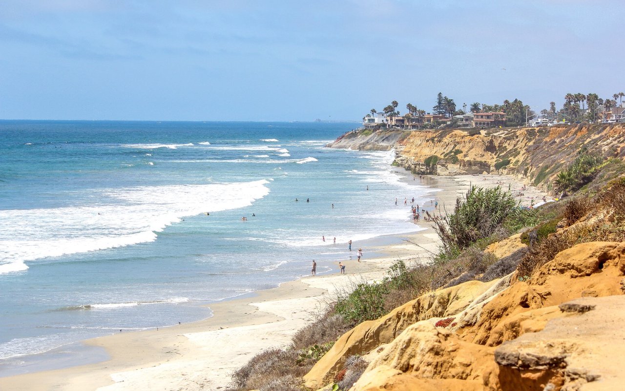
For commuting, Caltrain’s San Mateo, Hayward Park, and Hillsdale stations anchor rail access up and down the Peninsula. You also have U.S. 101 and I‑280 for drivers, with El Camino Real as the local arterial. Check service patterns and station details on the Caltrain San Mateo page. The bayfront adds a major lifestyle perk, with long runs and bike rides along the Bay Trail and weekend time at places like Coyote Point Recreation Area.
On pricing, expect wide variation by neighborhood and home type. Recent third‑party reports noted a citywide median around $1,249,000 in late 2025, with some hillside pockets like Sugarloaf trending higher and condo‑heavy Downtown trending lower. Always rely on current, block‑level comps before you make a move.
Match your lifestyle to a neighborhood
- If your top priority is walkable cafés, evening restaurants, and easy rail access, focus on Downtown San Mateo and Bay Meadows.
- If you want larger yards, parks, and access to local schools, look at Hillsdale, Baywood/Aragon, and Highlands.
- If your weekends revolve around the Bay Trail, dog parks, or windier waterfront views, explore Shoreview, Seal Point, and Coyote Point areas.
- If you want quick freeway access and larger lots, check hill and knoll neighborhoods like Sugarloaf, Laurelwood, and parts of Highlands.
Neighborhood snapshots
Downtown San Mateo and Bay Meadows
You get a true pedestrian routine here: morning coffee runs, short errands, and a lively restaurant scene. Downtown’s grid puts you close to the San Mateo Caltrain station, while Bay Meadows was planned around transit and walkability. Explore the neighborhood vibe on the Bay Meadows site.
Central Park adds green space for picnics, playground time, and quiet walks. Inventory here often includes condos and townhomes, which can make entry costs more attainable compared to single‑family areas. Buyers who value a car‑light routine often prioritize these blocks.
Hillsdale and Hayward Park
If you want family‑friendly routines plus retail convenience, this area pairs neighborhood parks with quick access to grocery stores and the Hillsdale Shopping Center. The Hillsdale Caltrain station supports Peninsula commuting and hybrid work patterns. See station specifics on Transit Wiki’s Hillsdale page.
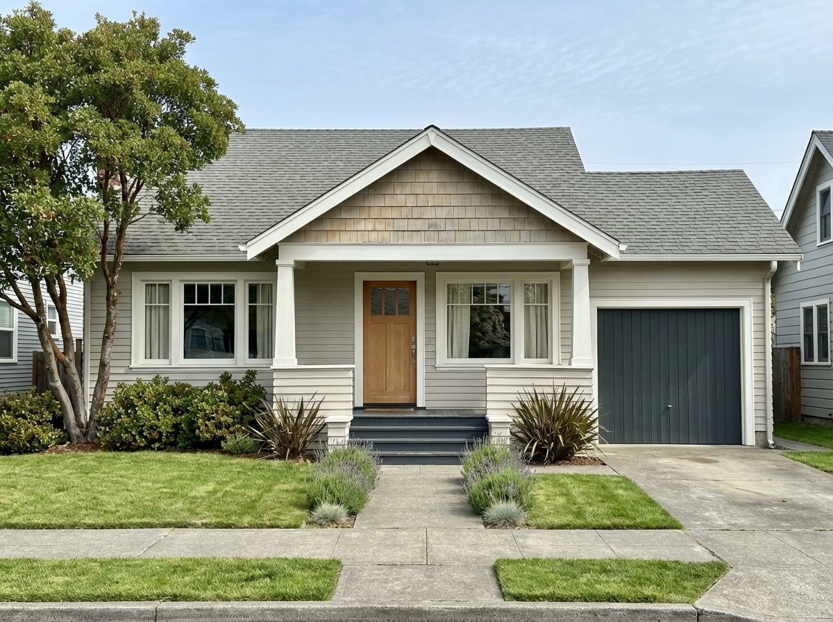
Road access to 101 and CA‑92 is straightforward, which helps for cross‑Bay or South Bay drives. Single‑family homes are common here, and competition can be strong for well‑located properties with yard space.
Shoreview, Seal Point, and Coyote Point
If daily fresh air is your reset button, the bayfront delivers. You can run or bike the Bay Trail, relax at Ryder Park, and let the dogs roam at Seal Point. Get a feel for the terrain with this Seal Point Park trail overview.
These neighborhoods sit east of 101, so many residents use the freeway or short drives to nearby Caltrain stations. Expect breezier weather near the water, and for low‑lying parcels, ask early about elevation, flood zones, and insurance.
Highlands, Baywood/Aragon, San Mateo Park, and Sugarloaf
Hillside and prestige pockets trade walk‑to‑everything convenience for larger lots, architectural variety, and quiet streets. San Mateo Highlands stands out for its extensive mid‑century homes and a community rec center. Baywood/Aragon and San Mateo Park feature established, tree‑lined streets and proximity to local schools and parks.
Drivers here often use I‑280 for southbound trips and El Camino or 101 for northbound commutes. These areas typically price above the city median, reflecting lot size, home scale, and views.
Condos and entry‑price clusters
If lower‑maintenance living and a first step into ownership appeal to you, look at condo and townhouse pockets downtown, Marina Lagoon, and select central blocks. These homes often trade private yard size for easier upkeep and access to transit or employers. Watch HOA details, rules, and monthly fees as part of your budget planning.
What to watch: development and change
San Mateo is planning for more housing near transit and downtown. The City’s 2023–2031 Housing Element and a 2024 voter measure increased capacity in targeted areas, which has already led to a pipeline of new proposals. That can bring new retail and services, as well as changes to traffic and streetscapes over time. Read more on the City’s Housing Element page.
Touring checklist: what to notice
- Commute fit: Compare a drive vs. rail door‑to‑door time for your typical workdays. Confirm local, limited, or express service at your nearest Caltrain station on the San Mateo station page.
- Last‑mile details: Look for sidewalks, bike lanes, and nearby bus or shuttle stops. This matters if you plan to live car‑light.
- Schools and enrollment: Ask for currently assigned schools and confirm boundaries with the district. Start with the San Mateo‑Foster City School District site.
- Flood and elevation: For bayfront or low‑lying homes, request the flood zone and insurance details, and check the City’s current FEMA flood map portal.
- Noise and activity: Visit at commute times to gauge freeway proximity, Caltrain vibration, or SFO flight paths.
- Nearby projects: Ask about any pending permits or new construction that could change traffic patterns or parking on your block.
- Ownership basics: For condos, review HOA rules, reserves, and fees. For single‑family homes, factor yard maintenance and parking into your routine.
Making your shortlist with a local plan
The best neighborhood is the one that fits your everyday life. Start by ranking your top three non‑negotiables, then tour during the hours you would normally be out. As you compare options, keep an eye on transit patterns, microclimate, and any flood, zoning, or airport considerations.
If you want a calm, organized search, work with an advisor who runs the process like a project. From school boundary checks to vendor coordination and timeline management, you should feel informed at every step. When you are ready to explore San Mateo homes, connect with Debbie Livingston for a plan tailored to your routines and priorities.
FAQs
Which San Mateo neighborhoods are most walkable to Caltrain?
- Downtown San Mateo and Bay Meadows are closest to stations, with Hillsdale and Hayward Park also offering practical walks or short bike rides to trains; confirm schedules on the Caltrain San Mateo page.
How does living near the bayfront affect weather and flood risk?
- Shoreline areas often feel breezier and foggier; for low‑elevation properties, verify flood zones and potential insurance needs using the City’s FEMA flood map portal, and preview outdoor terrain at Seal Point Park.
What are typical home prices by area in San Mateo?
- Prices vary widely by micro‑location and home type; late‑2025 snapshots showed a city median near $1.249M, with hillside pockets like Sugarloaf trending higher and condo‑heavy Downtown trending lower; ask for live, neighborhood‑specific comps before you decide.
How could the 2023–2031 Housing Element change my neighborhood?
- The plan increases housing capacity near transit and downtown, which can add new buildings, residents, and services over time; follow updates on the City’s Housing Element page.
What are the best commute options if I split time between San Francisco and the Peninsula?
- Many residents combine Caltrain for city trips with 101 or 280 for Peninsula drives; check train times on the Caltrain San Mateo page and test your door‑to‑door drive during typical commute hours.